
3D DATA &
LOS IN ATAK
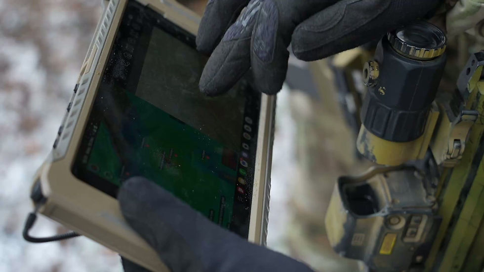
Terrain-accurate situational awareness for real-time operational decision-making

ATAK Training for Operational, Government and Security Users
Our ATAK training programmes are designed for a wide range of client groups, including military and defence forces, government and intelligence agencies, law enforcement, special units and organisations operating in complex or high-risk environments. Training is role-based, mission-focused and adapted to the operational reality of each client.

RF Spectrum Intelligence
in ATAK
CloudRF signal propagation and SIGINT layers embedded in ATAK

MEDICAL INTELLIGENCE FOR
CRITICAL MISSIONS
Our Medical Intelligence capability provides mission-critical insights to support teams operating in high-risk and remote environments. We combine geospatial data, medical risk analysis and operational planning to enhance preparedness, reduce exposure and enable faster, informed decisions during critical incidents.

One App,
all Operations
The ATAK app becomes a powerful GEOINT tool when paired with our solutions, giving operators instant access to satellite imagery, 3D terrain data and mission-critical overlays. This integration enhances situational awareness, improves planning, and supports faster, more informed decisions on the ground.


ATAK
DELTA
BMS GOV

REACH OUT NOW
B1A provides specialised BMS consulting for government clients, helping agencies design, integrate and optimise battlefield management systems for real operational use. We support ministries, armed forces and security services in building interoperable architectures, GEOINT-driven workflows and mission-ready digital environments that strengthen command, control and situational awareness across all levels of command.
